Apr 6, 2025
Across the Colorado River from the Arches National Park is Canyonlands National Park, and that was our destination for today. The Colorado River gouged many canyons along its way, and Canyonlands was an opportunity to see another set of them.
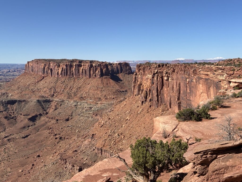
We started by driving to the end of the park and the Grand View Point lookout where you had a 270° panorama of the Canyon and the Colorado river. Across the river you could see many of the sites and monuments that we visited yesterday in the Arches National Park.
The canyons formed in this part of the river seem like a cross between those of the Grand Canyon and Bryce Canyon National Parks. The size, the length, and the sheer depth of the canyon reminds you of the Grand Canyon National Park, and the rich ochre colours, the strata, and the green vegetation overlaid by the remaining snow in the areas that the sun doesn’t reach, is very reminiscent of Bryce Canyon National Park.
After leaving the Grand View Point area, we headed back down the road stopping at various lookouts on the way. Interestingly, the most popular photo opportunity, that of Candlestick Tower, has no sign and one of the smallest parking bays in the park. However, it was great to see it.
The most spectacular views seemed to be of the Green River which flows past our cruddy motel, through some canyons and eventually joins with the Colorado upstream of the Grand Canyon.
The end of one of the roads led us to a formation that’s probably the most unusual in the park called Upheaval Dome. It’s actually a depression that doesn’t appear to have been caused by any river or water, and the most common explanation is that it’s actually the remains of meteorite strike which left a large crater in the countryside, which is now somewhat eroded.
Next stop was Mesa Arch which is the longest spanning arch in the park. Very like Nature’s Window in Western Australia, where you can look through the arch to the mountains behind or the canyon at its feet.
Lastly we stopped at Shafer Canyon Overlook where the track all the way down to the floor of the canyon begins. It was originally a path for Native Americans to access the valley floor, was then used by cowboys and sheep herders to move cattle, and was finally widened and improved many years ago when they were exploring for uranium. Nowadays it’s used by 4WD enthusiasts who want to explore the backcountry on a 2 day route.
We used to joke that the epitome of a young, poor backpacker doing a cross country road trip was eating $2 noodles and coke from a nondescript servo, and now we can report that the epitome of an old, grey, poor traveler doing a cross country road trip is eating $3 canned lasagne and diet coke from a nondescript servo.
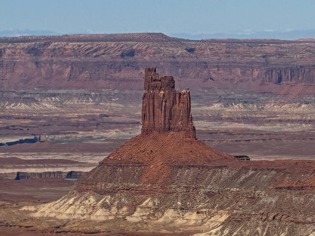
Candlestick Tower
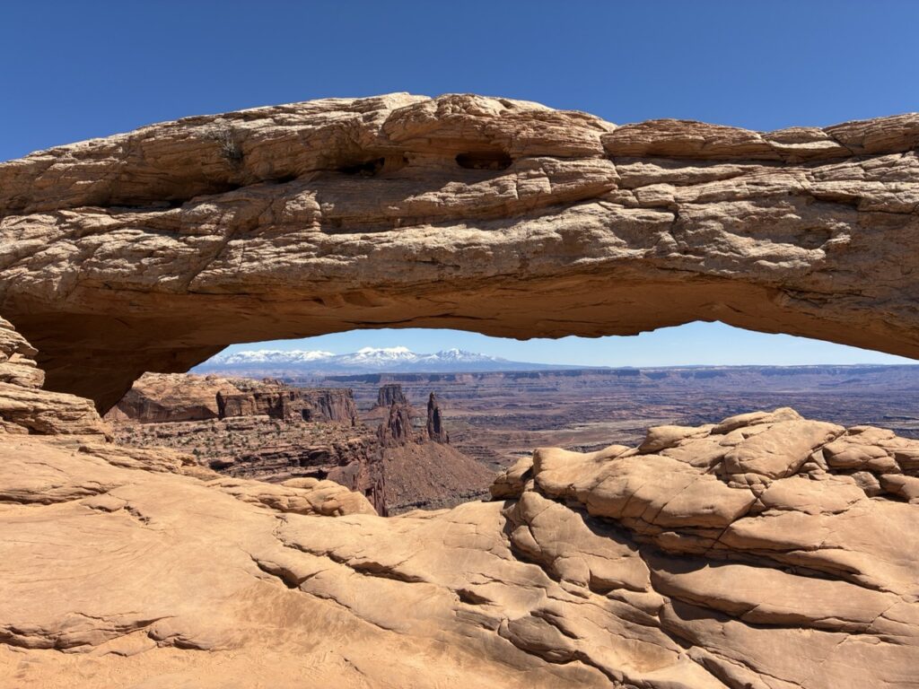
Mesa Arch
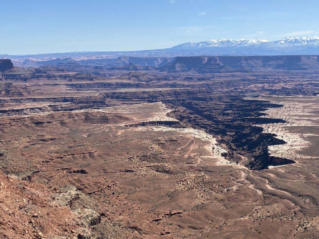
Buck Canyon
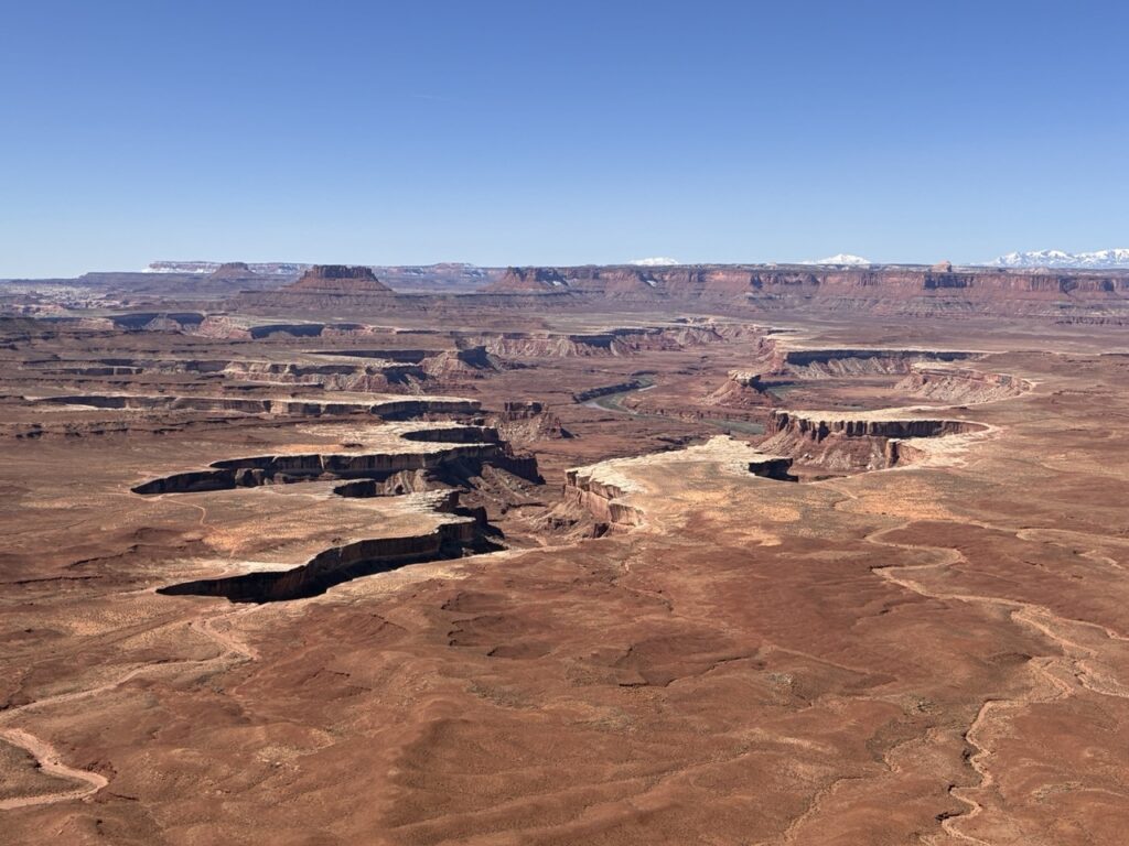
Green River
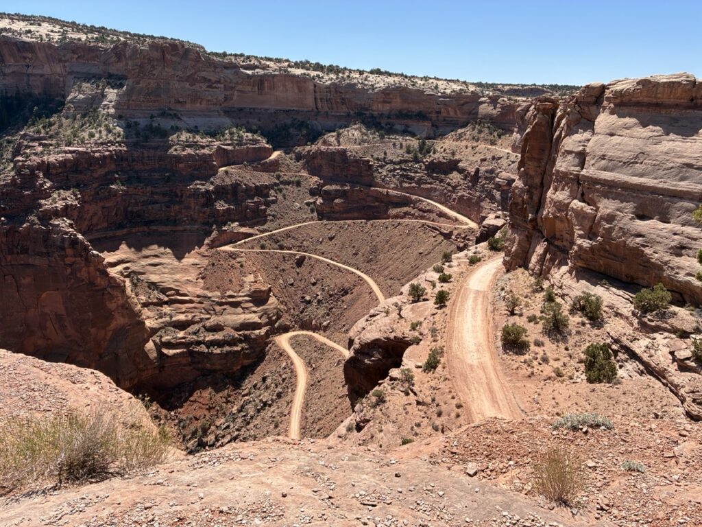
Shafer Canyon Access Track
Orange Cliffs